
Topographical Surveys Essex
At MARMIK Consultancy, we provide professional Topographical Surveys Essex, delivering precise land and site information for homeowners, architects, developers, engineers, commercial property owners and construction professionals.
Accurate site information forms the foundation of every successful construction, planning and development project.
Whether you’re planning a new development, extension, redevelopment or infrastructure project, our detailed topographical surveys provide the accurate information needed to design with confidence and reduce costly site errors.
Our surveys support planning applications, architectural design, engineering projects and land development across Essex and the surrounding counties.
What Is a Topographical Survey?
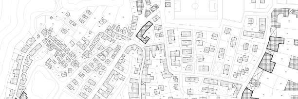
A topographical survey records the physical features, levels and characteristics of a piece of land.
Unlike a measured building survey, which concentrates on buildings, a topographical survey focuses on the surrounding site and everything located upon it.
The survey captures information including:
- Ground levels
- Site boundaries
- Buildings
- Roads
- Kerbs
- Footpaths
- Trees
- Fencing
- Walls
- Drainage features
- Utilities (visible)
- Street furniture
- Existing structures
- Hard landscaping
- Soft landscaping
- Changes in elevation
This information is used by architects, engineers and planning consultants when designing new developments or alterations.
Our Topographical Surveys Essex
MARMIK Consultancy undertakes topographical surveys for a wide range of projects across Essex.
These include:
Residential Developments
- Extensions
- Loft conversions
- Garage conversions
- New build homes
- Garden developments
- Property alterations
Commercial Developments
- Office developments
- Industrial units
- Retail premises
- Schools
- Healthcare buildings
- Commercial refurbishments
- Infrastructure projects
Land Development
- Housing developments
- Mixed-use schemes
- Site acquisitions
- Development feasibility
- Planning applications
- Engineering projects
What Information Is Included?
Every project is different, but surveys typically include:
Site Levels
Ground levels recorded across the site to assist drainage and engineering design.
Existing Buildings
Building footprints and structural positions.
Boundaries
- Walls
- Fences
- Hedges
- Boundary features
Roads & Access
- Car parks
- Footpaths
- Highways
- Vehicle access points
Landscaping
- Trees
- Shrubs
- Planting areas
- Retaining walls
- External features
Supporting Planning Applications
Planning consultants and architects require accurate site information before preparing drawings.
Our surveys provide an excellent foundation for:
- Planning applications
- Architectural design
- Engineering design
- Drainage strategies
- Site layouts
- Landscape design
Many clients combine this service with our Planning Services Essex for a streamlined planning process.

Supporting Construction Projects
Before contractors begin work, understanding existing site conditions is essential.
Our topographical surveys help construction professionals:
- Establish site levels
- Plan foundations
- Design drainage
- Position new buildings
- Reduce construction risks
- Improve project accuracy
Modern Surveying Technology
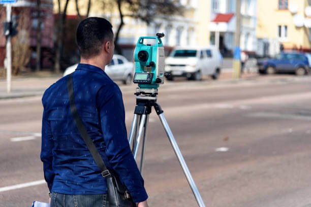
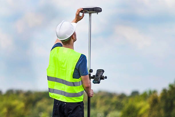
We utilise modern surveying equipment capable of capturing highly accurate land information efficiently.
Depending upon the project, surveys may incorporate:
- Electronic total stations
- GPS surveying
- Digital level equipment
- CAD production
- Drone-assisted aerial data where appropriate
Where additional roof or inaccessible area information is required, surveys can be complemented by our Drone Property Surveys Essex service.
Residential Topographical Surveys Essex
Homeowners frequently require topographical surveys before:
- Home extensions
- New build projects
- Garden rooms
- Annexes
- Driveway alterations
- Landscaping projects
- Boundary assessments
These surveys allow architects to design around existing site conditions with confidence.
Commercial Topographical Surveys Essex
Commercial clients instruct us for:
- Office developments
- Industrial estates
- Retail developments
- Schools
- Healthcare facilities
- Mixed-use developments
- Commercial refurbishments
Accurate survey information helps reduce delays during both planning and construction.
Why Choose MARMIK Consultancy?
We combine technical surveying expertise with wider property consultancy knowledge.
Clients benefit from:
- Accurate survey data
- Professional CAD drawings
- Residential & commercial expertise
- Independent consultancy
- Fast turnaround
- Modern survey equipment
- Local Essex knowledge
Unlike many survey providers, our services integrate seamlessly with our wider consultancy offering, including:
- Building Surveys Essex
- Property Surveyors Essex
- Structural Surveys Essex
- Building Defect Assessments Essex
- Measured Building Surveys Essex
- Planning Services Essex
- Insurance Claims Support Essex
Areas We Cover
We undertake Topographical Surveys throughout Essex including:
Chelmsford, Brentwood, Epping, Billericay, Basildon, Benfleet, Rayleigh, Rochford, Southend-on-Sea, Leigh-on-Sea, Colchester, Maldon, Witham, Braintree, Halstead, Harlow, Loughton, Chigwell, Wickford, Canvey Island, Grays, Thurrock, Upminster, Romford, Saffron Walden, Great Dunmow, Frinton-on-Sea, Walton-on-the-Naze, Harwich, Burnham-on-Crouch, Ingatestone, Shenfield, Hornchurch, and surrounding areas across Essex, Hertfordshire, London and the South East.
Frequently Asked Questions
What is the purpose of a topographical survey?
A topographical survey records existing site conditions to support planning, design and construction.
Do I need a topographical survey before building an extension?
Many architects recommend one to ensure designs accurately reflect existing site conditions.
Can topographical surveys support planning applications?
Yes. They provide essential information for architects and planning consultants.
Are utilities included?
Visible utility features can be recorded where appropriate, although specialist underground utility surveys may also be required.
Can drone surveys be combined?
Yes. Our Drone Property Surveys Essex service can provide aerial imagery and inaccessible area information where required.
Speak to MARMIK Consultancy
If you’re planning a development, extension or construction project, MARMIK Consultancy provides professional Topographical Surveys throughout Essex to support accurate planning and successful project delivery.
Our experienced consultants work with homeowners, developers, architects and commercial clients, providing reliable survey information that helps projects progress with confidence.